119. 全地球的航法衛星システム(GNSS)
GNSS(global navigation satellite system)は、ICAO によ り定義された衛星航法システムである。 GNSS を構成する 衛星システムとしては、アメリカが運用する GPS とロシ アが運用する GLONASS がある。 GPS や GLONASS は、単独では航空機の航法に要求される 航法性能を満足できないので補強システムが併用され、こ の補強システムも GNSS に含まれる。補強システムには静止 衛星を経由して航空機に補強情報を提供する SBAS, 地上か ら VHF 帯の信号により航空機に補強情報を提供する GBAS および機上システム単体で補強を行う ABAS がある。
a. GPS(全地球的測位システム):
GPS (global positioning system)は、アメリカ国防省により管理・ 運用される人工衛星による測位システムであるが、民間に も広く開放され、簡便で精度の高い測位システムである。 ただし航空機の航法にお いて、GPS 単独では必要な要件(完 全 性 / integrity,精 度 / accuracy, 利 用 可 能 性 / availability, 利用の継続性/ continuity)をすべては満足しないため、補強 システムを使用する必要がある。 なお、GPS は航空法上は 航空保安無線施設に含まれていない。 [549 f ],[954]
a ) GPS の特徴: GPS は、従来の航法システムに比べて精度が高いこ と, 洋上や山岳地域等の地上無線施設が利用できない 空域でも利用可能なこと, 高速移動中であっても多数 の利用者が同時に利用可能なことなどの特徴がある。 GPS は、高度約 20,000 キロメートルの 6 つの周回軌 道に各々最低 4 個、合計 24 個以上配置された人工衛 星と衛星を維持管理する地上システムにより構成され ている。 GPS は位置算出に必要な数の衛星を受信でき るところであれば、地球上どこでも高い精度の位置情 報を得ることが可能なシステムである。 GPS が提供す る位置の精度は VOR/DME 等よりも高い(一般的に水 平方向誤差約 20 メートル、垂直方向誤差約 30 メート ル)が、利用可能性やサービスの継続性の問題があり、 すべての飛行フェーズ(出発、巡航、進入、着陸)に わたって GPS を使用するには、GPS 補強信号が提供さ れていることが必要である。
b) 測位方法: GPS の各衛星から発信された信号の発信時刻と航空 機での受信時刻の差(信号の伝搬時間)を測定する ことによって、衛星と航空機間の距離が計算される。 GPS 衛星には原子時計が搭載されており正確な時刻が 刻まれているが、GPS 受信機には原子時計ほど正確な 時計が搭載されていないため、時刻校正のために4個 以上の GPS 衛星からの信号を受信し、受信点における 3 次元位置が決定される。 GPS の測位誤差要因には、 衛星の配置, 衛星に搭載された時計の誤差, 電離層と 対流圏における電波伝搬速度の遅延, マルチパスや受 信機の計算誤差等がある。
b . SBAS(静止衛星型衛星航法補強システム): SBAS (satellite-based augmentation system) は、 静 止 衛 星から コア衛星である GPS の補強信号を放送する補強シ ステムで、補強信号は航空路からターミナルにおける進 入フェーズまで広い範囲にわたって提供される。 SBAS は GPS から放送される信号を監視する監視局、監視局で得ら れたデータを収集し GPS 補強信号を生成する統制局、GPS 補強信号を静止衛星に送信するアップリンク局などで構成 される。 SBAS の補強信号には GPS 信号を地上局で監視し その信頼性情報を航空機に提供する機能(インテグリティ
機能)、測位精度を向上させるための補正情報を提供する 機能(ディファレンシャル補正機能)および GPS と同様の 測位信号を提供する機能(レンジング機能)が含まれてい る。 SBAS は GPS と同じ周波数を用いているが、利用する には SBAS に対応した受信機が必要である。
稼 働 中 の SBAS と し て は、 米 国 の WAAS(wide area augmentation sysytem), 日 本 の MSAS(MTSAT satellite-based augmentation system), ヨ ー ロ ッ パ の EGNOS(European geostationary navigation overlay service) お よ び イ ン ド の GAGAN(GPS aided geo augmented navigation)がある。
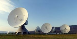
MSAS は、札幌, 東京および福岡の各航空交通管制部、 那覇空港事務所、神戸と常陸太田の航空衛星センターに設 置された監視局で得られた GPS 信号が航法統制局(神戸 および常陸太田航空衛星センター)に送られ、GPS 補強信 号が生成され、アップリンクシステムを経由して MTSAT に送信される。 MSAS による GPS 補強信号が提供できない 場合、および MSAS が提供する航法サービスを利用できな いことが予測される場合は、ノータムにより通知される。 c. GBAS(地上型衛星航法補強システム):
GBAS(ground-based augmentation system)は 、GPS に よ る精密進入を行うために、地上施設から GPS の精度や完 全性を向上させる補強情報や 航空機の進入降下経路情報 を送信し、航空機を滑走路へ誘導するための装置である。 水平方向と垂直方向のガイダンスは ILS と同様に表示され る。
GBAS は、狭い範囲(半径 23 マイル)に 限 定 し て 補 強 情 報 を 提 供 す る た め 、高 い 精 度 お よ び 完 全 性 を 得 る こ と が で き 、CAT Ⅲカテゴリー進入が可能となっている。 オーストラリア, 米国, ドイツ, スイス等で GBAS による CAT Ⅰ運用が実施されており、日本では現在羽田空港にお いて整備が進められている。 d . ABAS(航空機搭載型衛星航法補強システム):
ABAS(aircraft-based augmentation system) は、 航 空 機 の搭載機器等から得られる情報をもとに、GPS が満たす ことができない完全性を補うシステムである。 最も一般 的な ABAS としては、GPS 受信機の内部処理で実現される RAIM(receiver autonomous integrity monitoring)がある。
[954]
119. GNSS
GNSS (global navigation satellite system)is a satellite based navigation system defined by ICAO. Currently, GPS operated by the U. S. Department of Defense and GLONASS operated by the Russian government are available as means of GNSS. The required accuracy is not achieved by GPS or GLONASS alone; therefore, either system requires an augmentation unit as an integrated part of the system. The augmentation methods include SBAS utilizing geostationary satellites, ground based GBAS and airborne equipment of ABAS.
a. GPS (global positioning system):
GPS is a satellite-based radio navigational, positioning, and time transfer system controlled and operated by the U. S. Department of Defense available to civil users as a means of highly accurate navigation. However, the required integrity, accuracy, availability and continuity in the aircraft navigation are not fully provided by GPS alone. Therefore, augmentation systems are necessary in order to achieve requirements. GPS is not specified as a navaid by the CAL. [953] a) Characteristics:
GPS has a greater accuracy than the conventional
navigation systems and most receivers are capable of
simultaneously receiving and using during high-speed
transportation anywhere on the earth.
There are six orbital planes containing at least four
satellites on each and equally spaced 20,000 km above
the surface. GPS system consists of 24 satellites (four on
each orbital plane) or more that orbit the earth and the supporting unit on the ground.
Ch.
1
When required number of satellites are received, highly accurate position can be obtained anywhere on the earth. The position information provided by GPS has a higher accuracy than that of VOR/DME (generally, errors are within 20m horizontally, and 30m vertically). However, when the signals are used throughout all flight phases (departure, cruise, approach and landing), a differential GPS is required due to lack of the availability and continuity.
b) Computing mechanism:
A GPS receiver computes the distance from each satellite
by detecting times of transmission and reception (travel
time of radio signals). An atomic clock onboard GPS indicates accurate time, while a GPS receiver which
does not contain any accurate clock determines a tri-
dimensional position by correcting time with signals
from at least four satellites. Errors may be created by
the configuration of the satellites. atomic clock itself,
delay in travel speed of signals in the ionosphere and
troposphere, and multi-path as well as computing error
by a receiver.
b. SBAS (satellite-based augmentation system):
SBAS is a satellite-based augmentation system which broadcasts GPS augmentation signals from a geostationary satellite for various purposes from en route to terminal areas. SBAS typically consists of the monitoring stations that monitor signals from GPS, the controlling stations that generate augmented signals based on the data collected by the monitoring stations, and the up-link stations.
The same frequency is used for SBAS as GPS, however, a SBAS capable receiver is required when using SBAS. Currently, US WAAS (wide area augmentation system) , Japanese MSAS (MTSAT satellite-based augmentation system), European EGNOS (European geostationary navigation overlay service) and Indian GAGAN(GPS aided geo augmented navigation)systems are in practical operations.
MSAS informs aircraft of any deterioration of GPS signals monitored by the ground stations (integrity function), enhances the accuracy of signals (differential function) with the supplementary information and then provides an equal quality of ranging signals to GPS (ranging function) via MTSAT (multi-functional transport satellite). GPS signals are obtained by the ground monitoring stations at Sapporo, Tokyo, Fukuoka and Naha ACCs, and forwarded to the master control stations (Kobe and Hitachi-Ohta) to synthesize GPS augmentation signals.
GPS augmentation signals are transmitted to MTSAT via an up-link system, and then broadcasted for users. Also, the monitoring and ranging stations are located at Hawaii and Australia in order to adjust the orbit of MTSAT correctly. The MTSAT is controlled on the required orbit precisely predicated on the data collected by the two monitoring and ranging stations.
These stations literally provide monitoring function as well. A relevant NOTAM may be issued when neither augmentation signals are not obtained by MSAS nor any navigational service predicated on MSAS is not available. c. GBAS (ground-based augmentation system):
Through VHF frequencies, GBAS provides GPS augmentation signals that are created from signals received at the monitoring stations. Augmented GPS information is received by in-flight aircraft to display on the cockpit instrument likewise ILS in terms of horizontal and vertical deviations.
The coverage of GBAS is rather limited (20 ~ 30nm radius of the station), however, more accurate signals are provided than SBAS to enable a CAT Ⅱ or CAT Ⅲ high category approach. Trial operations of CAT I approach are being conducted in Australia, the U. S. and Germany.
d. ABAS (aircraft-based augmentation system):
ABAS supplements a gap which is not filled with other augmentation methods predicated on the information from airborne equipment. The most common form of ABAS is RAIM(receiver autonomous integrity monitoring) function incorporated in GPS receivers. [953]